


Dave Catts
Current Gallery: westcoast ( piece)
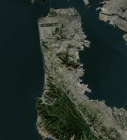
Images of the West Coast of the United States predominately images along the Pacific Coast; and mountains in the Sierra Nevada Range of California, and the Cascade Range in Oregon and Washington: birds-eye views of familiar places, camping, hiking and fishing spots: geography, places to visit and recreate. The map titles are from a central physiographic feature and contain over-edge. All images are vertical views (planimetric) of 3D environmental models, and the image corners are specific geographic coordinates (georectified). These images are 10,000-pixels in the longest dimension; so they can accommodate the "Massive" print size at Imagekind.
Images of the West Coast of the United States predominately images along the Pacific Coast; and mountains in the Sierra Nevada Range of California, and the Cascade Range in Oregon and Washington: birds-eye views of familiar places, camping, hiking and fishing spots: geography, places to visit and recreate. The map titles are from a central physiographic feature and contain over-edge. All images are vertical views (planimetric) of 3D environmental models, and the image corners are specific geographic coordinates (georectified). These images are 10,000-pixels in the longest dimension; so they can accommodate the "Massive" print size at Imagekind.
Gallery-quality prints · Independent artists · Décor to adore


from $ 63

from $ 63

from $ 63

from $ 63

from $ 63

from $ 63

from $ 63

from $ 63

from $ 63

from $ 63

from $ 63

from $ 63

from $ 63
from $ 63

from $ 63

from $ 63

from $ 63